Chapter 8. Nitrogen in the Bay

Long-term Data Monitoring Indicates Nitrogen Levels are Decreasing in Waters around Portland

Improvements in Stormwater and Wastewater Infrastructure are Most Likely Responsible for Nitrogen Decreases

At a Glance

More long-term nitrogen records are becoming available, allowing us to monitor trends at more sites.

50% of sites show decreasing trends and 50% show stable trends. No sites are showing increases.

Generally, the sites where nitrogen is decreasing are those that historically had the highest levels.

Upper estuaries of Casco Bay (Fore River, Presumpscot, Royal River, Harraseeket, and New Meadows) consistently have the highest nitrogen concentrations.

Atmospheric deposition of nitrogen has declined since the 1990s, but may be stabilizing.

Since the 2021 Report

Through Friends of Casco Bay’s continued sampling efforts, there are now more sites for which long-term total nitrogen data is available, providing evidence of decreasing nitrogen levels at more sites.

While total nitrogen concentrations are trending downward, sites are exceeding Maine Department of Environmental Protection’s (DEP’s) nitrogen thresholds at the same frequency. The one exception is Fort Gorges, which exceeded thresholds frequently from 2016-2018 while the East End Wastewater Treatment Plant was being upgraded and their nitrogen scrubbing system was shut down. With the upgraded systems online, Fort Gorges has not exceeded thresholds in the last five years.

The average rate of atmospheric deposition of nitrogen from 2020-2024 is almost identical to what it was from 2015 – 2019.

Nitrogen is the limiting nutrient in most marine ecosystems, including Casco Bay. High levels of bioavailable nitrogen can trigger excessive growth of algae, leading to harmful algae blooms and low dissolved oxygen as the excess algae decompose in the water column. These conditions threaten eelgrass, kelp, shellfish, fish, and the systems (ecological and economic) that rely on them.

Nitrogen can make its way into Casco Bay by runoff (including stormwater, combined sewer overflows and river flows), wastewater treatment plant outflows, and atmospheric deposition (including precipitation). There are currently six major municipal wastewater treatment plants with outflows directly to Casco Bay and numerous smaller point sources. Three major rivers (Presumpscot, Royal, and Stroudwater), and thirty smaller tributaries also contribute nitrogen loads to Casco Bay.
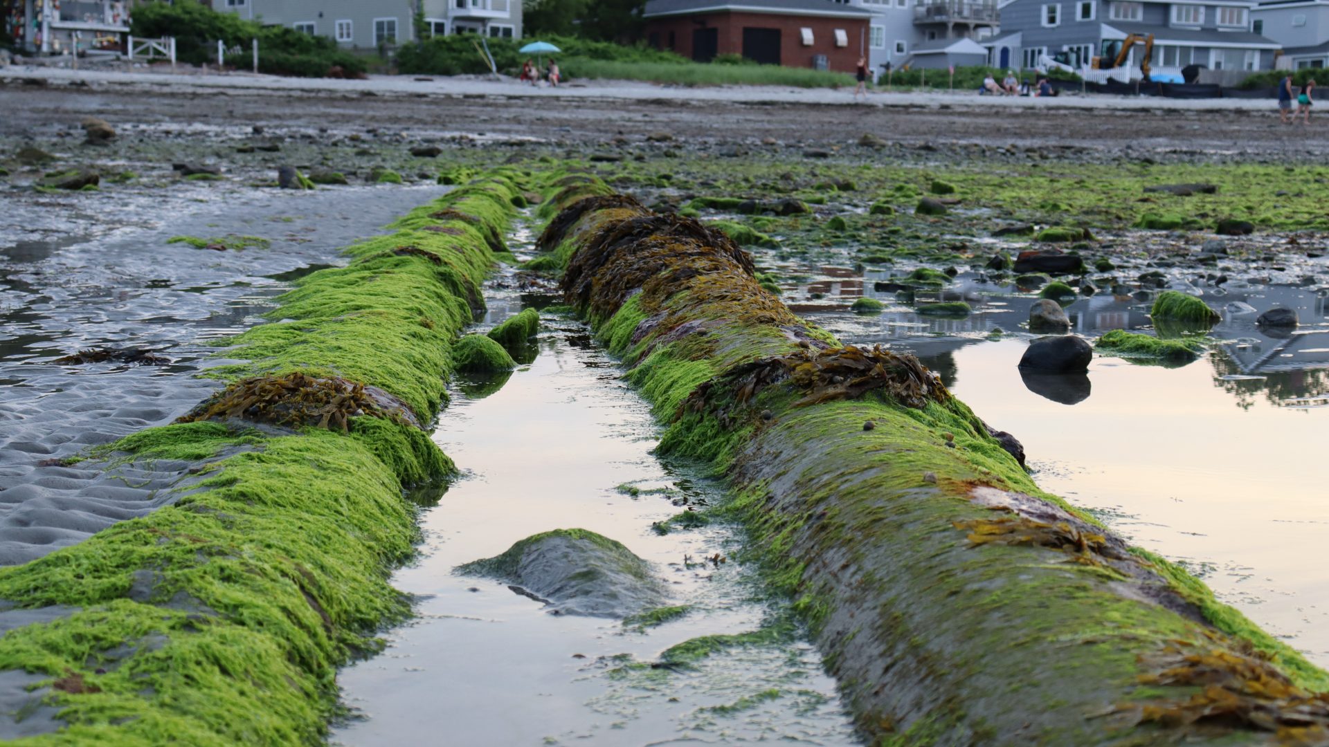
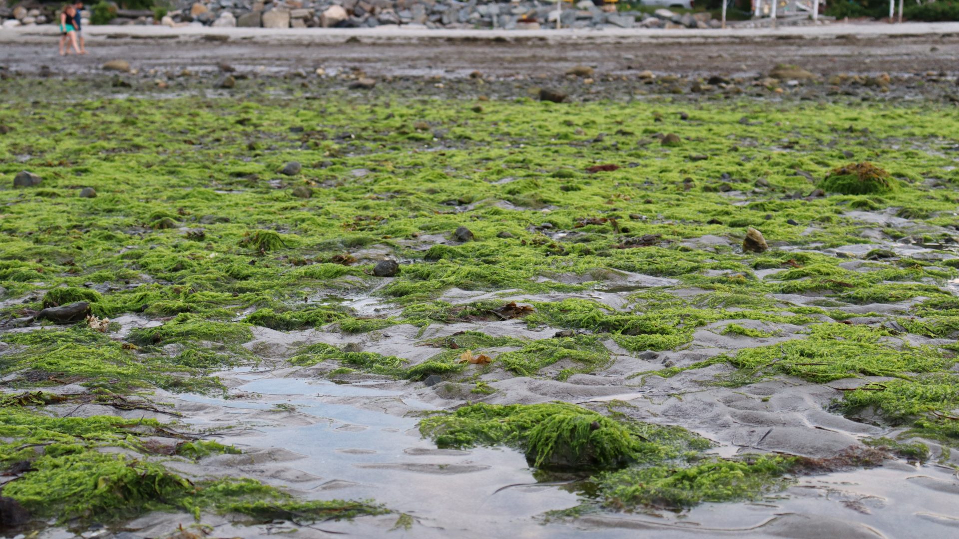
Ch. 8 Willard Beach algal bloom 2024 2 Photo Meghan Vigeant
Willard Beach algal bloom, 2024 (Photo: Meghan Vigeant)

Many Sites with Historically High Nitrogen are Seeing Decreasing Concentrations

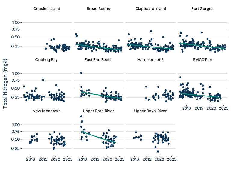
There are many forms of nitrogen in aquatic ecosystems. Friends of Casco Bay monitors total nitrogen (TN), which is the sum of all forms. Sites in the Greater Portland area with historically high total nitrogen concentrations are continuing to see decreases. These sites include the pier at Southern Maine Community College, the Upper Fore River, East End Beach, and Fort Gorges.

Improvements in stormwater and wastewater infrastructure that reduce nutrient loading to the Bay are most likely responsible for these decreases. Broad Sound and Clapboard Island are also experiencing declining nitrogen concentrations, but are not near Portland Harbor, so the reasons for those declines are not clear.

Estuaries outside of Portland, including the Royal River and New Meadows, continue to experience frequent high concentrations of nitrogen.

Figure 1. Total nitrogen measured at sites in Casco Bay over the last two decades.

All Regions Have Occasionally Exceeded DEP Nitrogen Thresholds in Recent Years, Some Regions Rarely Fall Below Them

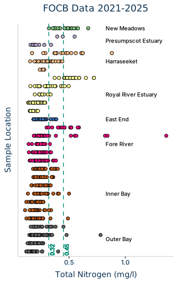
Figure 2. Total nitrogen measured at sites in each region of Casco Bay from 2021 to 2025. Regions are ordered from highest to lowest average total nitrogen concentrations, and each row represents a site within the region.


The Outer Bay region, an area which includes the Harpswell peninsulas and open water portions of Casco Bay, has the cleanest water as it experiences the most flushing from the open ocean.

Over the last five years, even sites in the Outer Bay occasionally exceeded Maine Department of Environmental Protection’s (DEP’s) nitrogen advisory thresholds (0.32 mg/l TN to protect eelgrass; 0.45 mg/l TN to reduce risk of low dissolved oxygen). Comparatively, the New Meadows River and some sites in the Presumpscot and Royal River estuaries rarely dipped below those thresholds. This indicates that nutrient loading from tributaries continues to be a cause of concern for Casco Bay.

Ch. 8 Willard Beach algal bloom 2024 Photo Meghan Vigeant
Willard Beach algal bloom, 2024 (Photo: Meghan Vigeant)

Declining Atmospheric Nitrogen Deposition

Atmospheric deposition of nitrogen is monitored by Maine DEP at a station at Wolfe’s Neck in Freeport.

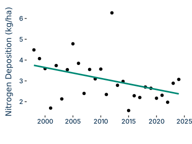
Apart from a highly localized spike in 2012, atmospheric deposition has consistently declined since the late 1990s. While long term trend analysis still finds a significant linear decline, the five year periods from 2015 – 2019 and 2020 – 2024 had similar annual average deposition rates (2.28 kg/ha/yr and 2.48 kg/ha/yr respectively), suggesting the deposition rate may be stabilizing.

Figure 3. The nitrogen deposition rate calculated at Wolfe’s Neck in Freeport over the last three decades is declining, but may be stabilizing.

Looking ahead to 2030

Sites in the Greater Portland Area are showing decreasing levels of nitrogen but some nitrogen enriched outside of Portland (Royal River and New Meadows River), continue to have higher concentrations.

Infrastructure in these areas may need to be updated in order for nitrogen levels to decrease. Tributary nutrient data is lacking and efforts may need to be made to understand levels in these bodies of water. Efforts are underway to directly monitor nitrogen concentrations  in stormwater in urban areas.

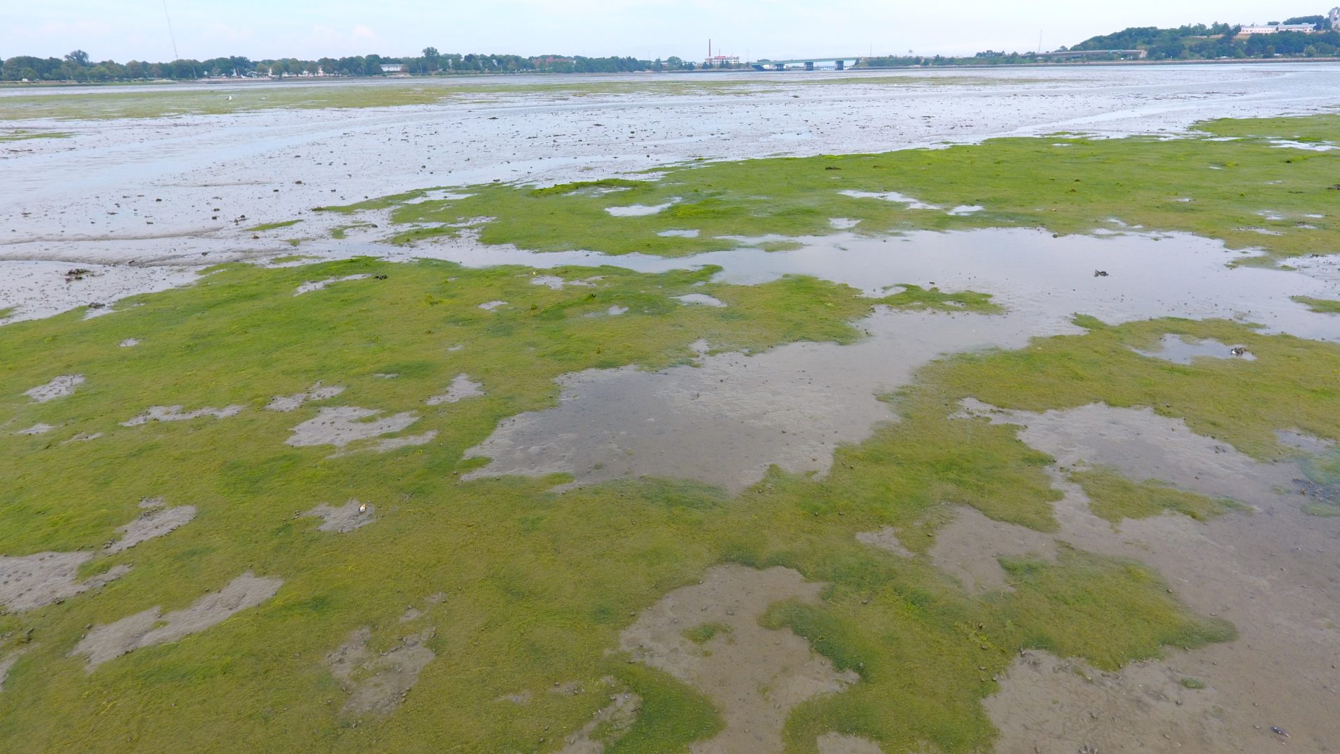
DCIM100MEDIADJI_0190.JPG
Algal bloom (Image: Friends of Casco Bay)