The Pace of Permanent Land Conservation in the Casco Bay Watershed Reached an All-time High In the Last Five Years
At a Glance
Conserved land is important to protect clean water, preserve ecological communities, enhance climate resilience, sustain working forests and farms, and provide access to open space and outdoor recreation.
By the end of 2025, a record 13.8% of the Casco Bay watershed had permanent protected status.
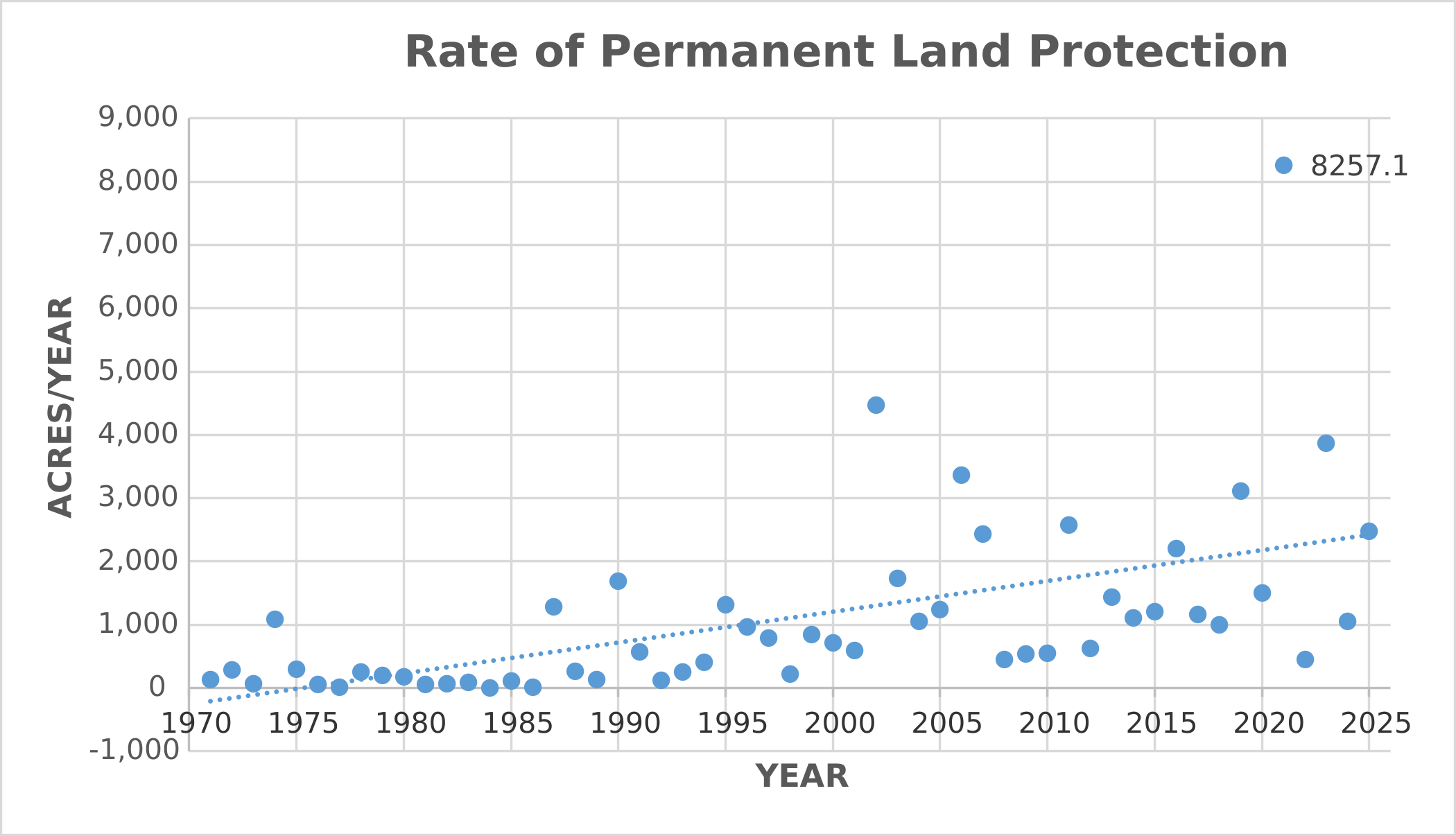
Despite this remarkable achievement, the pace of conservation would need to increase by 140% to reach the goal of protecting 20% of the watershed by 2030.
Since the 2021 Report
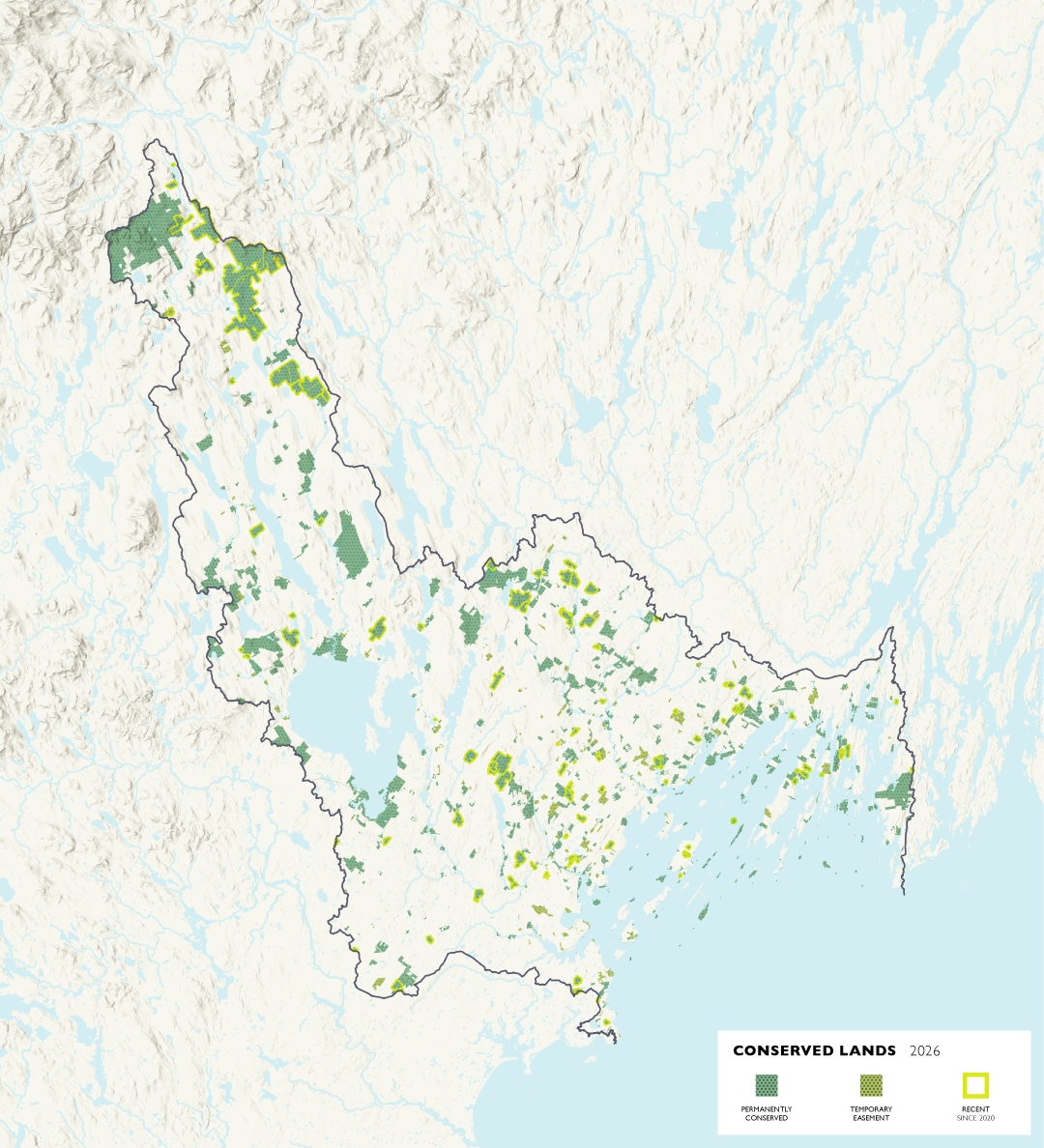
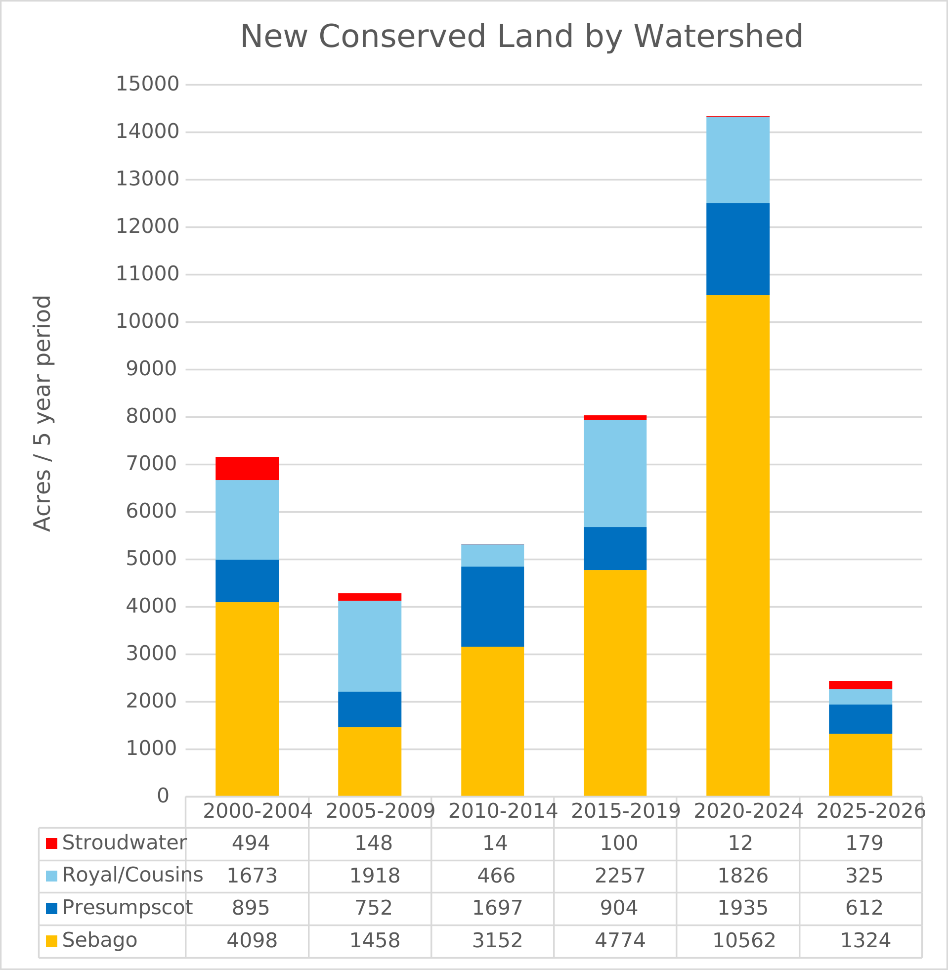
The last five years have set a record pace for conservation work in Casco Bay, with much of the gains in the upper watershed. Since 2019, 16,775 acres of land have been conserved and 70.8% of that conserved land is in the Sebago Lake watershed. By the end of 2025, a total of 79,626 acres in the watershed had been permanently protected, the equivalent of 13.8% of the Casco Bay watershed.
Conserved land is land that is legally protected from uses that would impair any natural, ecological, or community-centric values. It is largely protected from residential or commercial development, remaining instead in a natural state for fish and wildlife, but may allow sustainable land uses such as agriculture and forestry.
The U.S. Geological Survey’s Gap Analysis Project (GAP) establishes standardized categories for protection status. GAP Status Codes 1-3 are classified as permanently protected, and predominantly, the protection mechanism is through fee ownership and conservation easements, and includes natural areas owned by public entities. Although we are describing parcels with GAP Status Code 4 as temporarily protected, in practice, GAP 4 parcels include many parcels that are partially developed such as golf courses, school campuses, and ball fields, that lack a known conservation mechanism that would prevent development or conservation of natural habitat. CBEP considers conservation land to enjoy permanent protection (GAP status 1-3) and allow for low-impact recreation (e.g., hiking or birdwatching) but does not include land that is predominantly recreational such as ball fields or playgrounds. Keeping track of conserved lands over time helps illustrate the level of success conservation partners have had in protecting land. The actual rate of protection may reflect the availability of funding sources and the cost of acquiring land.
Throughout Casco Bay’s watershed, and particularly in proximity to Portland, land is being developed in response to demand for residential, commercial, or industrial property, fueled by changing patterns in where people work and live. Setting aside a network of natural areas in perpetuity serves to protect clean water, conserve ecological communities, enhance climate resilience, sustain working forests and farms, and provide access to open space and outdoor recreation. Many conservation organizations now work closely with communities to support residential housing that is complementary to land protection, and provide access for traditional and cultural uses.
One challenge to conserving land in the Casco Bay region is the lack of regional conservation funding mechanisms to help address the higher cost of conservation work in this part of the state.