Chapter 2. Wastewater Disposal

Many Septic Systems are Located on Vulnerable Soils Near Water

But the Number of Overboard Discharges Has Declined

At a Glance

Only a small portion of the Casco Bay watershed is served by wastewater treatment facilities. On-site wastewater systems pose potential threats to water quality, but those threats are unevenly distributed.

Harpswell and Sebago Lake are particularly vulnerable to contamination from on-site wastewater disposal because of their soil types and the proximity of wastewater systems to water.

Septic systems are difficult to map across the entire region, but knowing system locations and vulnerability helps managers and scientists protect sensitive waterbodies.

Growing populations in the region increase the need for effective sewage treatment, whether via centralized wastewater facilities or on-site systems like septic tanks.

Since the 2021 Report

Recent studies have identified areas where septic tanks are most likely to pose threats to water quality. As understanding the geography of wastewater treatment improves, more cost-effective strategies for investment in sewer systems, community-level treatment facilities, private septic systems and other wastewater infrastructure to protect water quality and human health can be developed.

Untreated sewage from our homes and businesses carries pathogens that put human health at risk, nutrients that threaten water quality, and other pollutants. Wastewater produced in residential or commercial buildings can either be directed into a sewer system for offsite treatment at a wastewater treatment plant or disposed of onsite via a septic system or an overboard discharge (OBD).

On-site systems can protect human health and water quality when properly installed and maintained, but with tens of thousands of septic tanks and dozens of OBDs in the region, cumulative effects – especially on vulnerable water bodies like lakes – can be important even when systems work as designed. Inevitably, some systems do not function as intended, posing additional threats.

Both septic systems and OBDs are regulated by the state, as improperly installed or maintained systems can threaten waterbodies. Out-of-date and malfunctioning systems can introduce excess nutrients and bacteria into waterbodies, triggering algae blooms and contaminating shellfish. Since most OBDs discharge directly to coastal surface waters, the state preemptively restricts shellfish harvesting in their proximity out of contamination concerns.
Identifying Areas with At-Risk Septic Systems

Older septic systems, systems in vulnerable soils, and systems near waterbodies all have a higher chance of posing a threat to water quality. Septic system requirements have changed over time, notably in 1974 and 1995 when significant updates were made to location and installation requirements. As a result, systems installed before 1995 have a higher risk of impacting water quality than modern systems, and the risk is even higher for systems installed before 1974.

Vulnerable soils are certain types or combinations of soils that have a high risk of “short-circuiting” – when water flows through the system too quickly and exits without being fully treated. Systems located near waterbodies pose an additional risk by inherently having a shorter distance for discharged water to travel, and less time for it to be properly filtered. The Town of Brunswick completed a town-wide Septic System Vulnerability Assessment by mapping septic system locations alongside these age, soil characteristics, and proximity to waterbodies. Through an enormous effort to hunt down and geolocate septic system permits and an award winning GIS analysis, the town identified 3,761 documented and 836 suspected properties with septic systems. 2,219 of those properties are within the Casco Bay watershed.

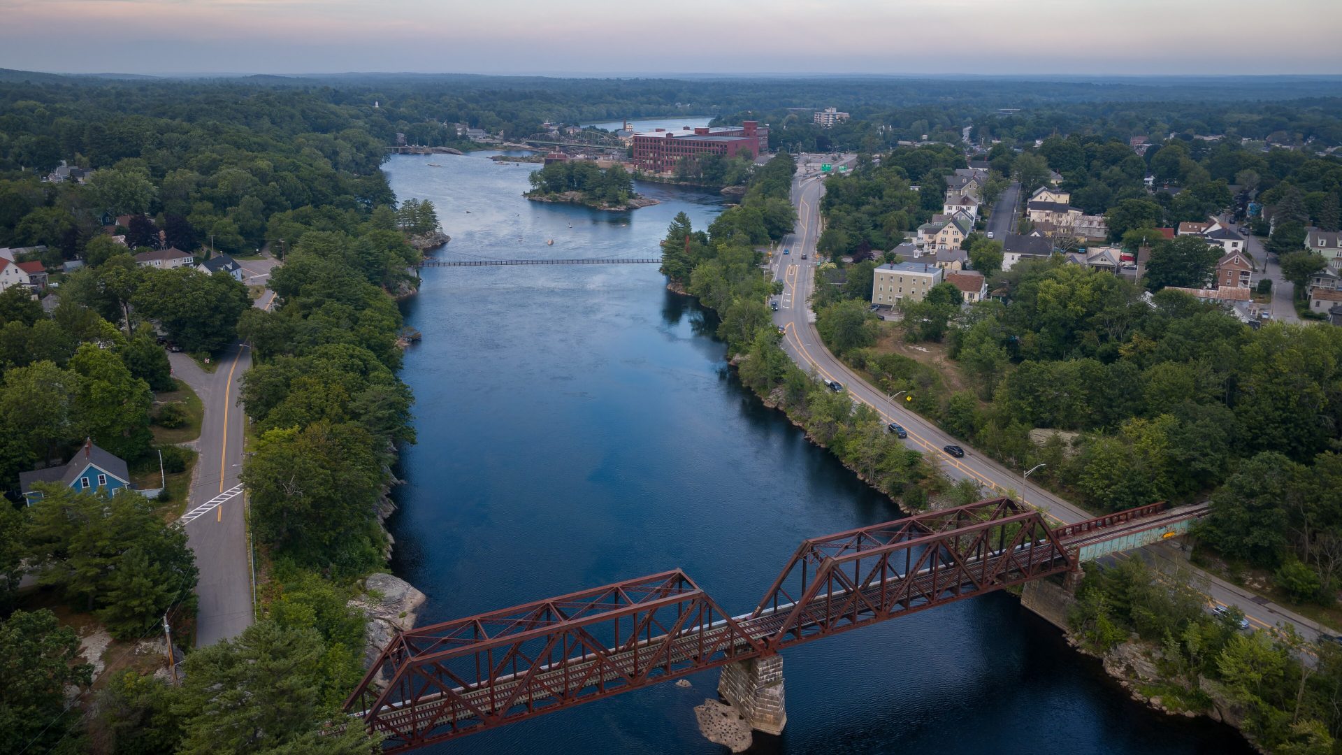
Androscoggin_River_Reservoir,_with_the_Free-Black_railroad_bridge_in_the_foreground,_Brunswick,_Maine,_US_(PPL1-Corrected)_julesvernex2
Androscoggin River Reservoir, Brunswick (Photo: Jules Verne Times Two / julesvernex2.com / CC-BY-SA-4.0)

Historic Septic Permits Pose Challenges

Town Total Area in watershed (acres) Area of vulnerable soils near waterbodies (acres) Estimated # of septic systems in watershed Estimated # of septic systems on vulnerable soils near water
Harpswell 15234 4339 4333 1234
Windham 29663 1645 9011 500
Standish 10551 2619 2882 427
Raymond 20240 1956 3300 313
Naples 20226 2080 2927 301
Gray 27635 1801 2962 193
Gorham 31167 1177 4763 177
Casco 15222 1346 2170 169
West Bath 4356 1204 802 166
Brunswick* 13848 1586 2219 75

* Values for the Town of Brunswick are from the town’s Septic System Vulnerability Assessment work, not estimated by CBEP.

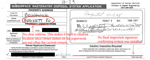
Associating older septic system permits with properties is a slow and painstaking process that poses a barrier to tracking septic systems in the watershed.

Many permits have missing or out of date address information that prevents matching the system with a property. Additionally, systems installed prior to 1974 don’t typically have permits and are largely undocumented. Identification of additional septic systems locations by CCSWCD would require a time-intensive investigation of the remaining tens of thousands of permits on an individual basis.

An example of a septic system permit with missing information from 1985. Image: Town of Brunswick


Mackerel_Cove
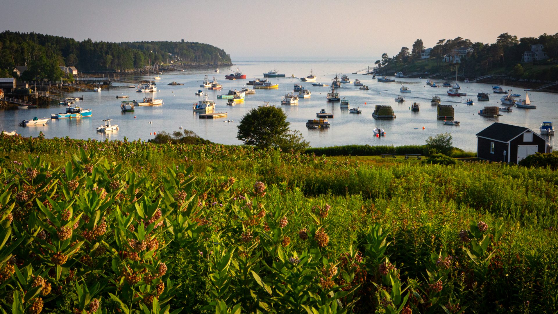
The sun sets over Mackerel Cove on Bailey Island, Harpswell. (Image: Troy R. Bennett)

Harpswell and Sebago Lake Particularly Vulnerable

Based on CCSWCD’s preliminary results, we estimated the number of septic tanks that may occur on vulnerable soils near waterbodies in each town in the Casco Bay watershed. Harpswell had the highest estimated number of vulnerable septic systems, followed by the inland towns surrounding Sebago Lake.

Harpswell is so highly vulnerable because most of the town has shallow bedrock, which makes soils vulnerable to short circuiting, and the peninsular geography of the town means nearly every property is near water. It is also home to many clam harvesters and aquaculture farms (see Living Resources), so failing systems have the potential to impact shellfish resources.

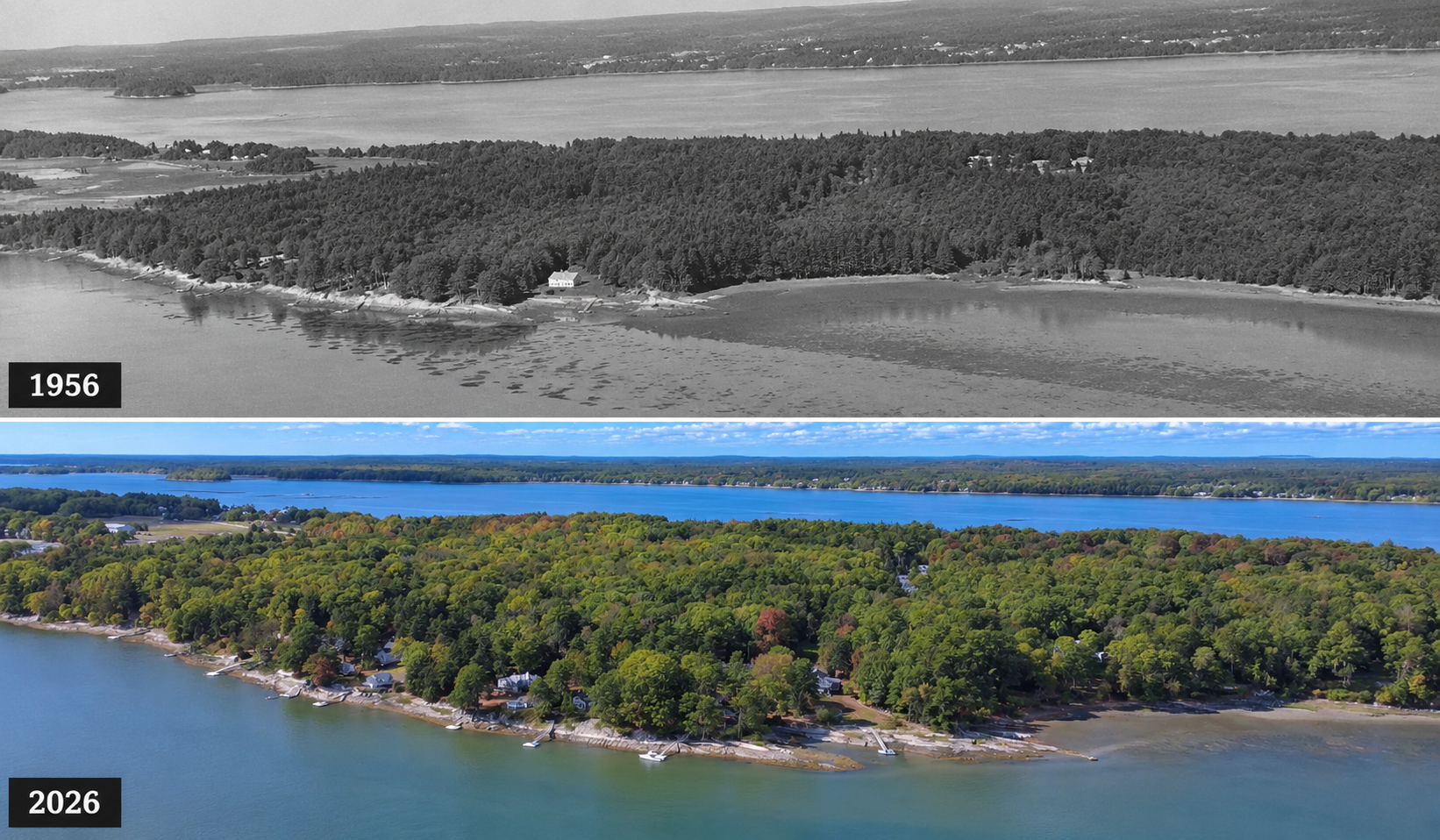
Development of waterfront properties on Minot Shore in Brunswick from 1956 to 2026. Photos: Town of Brunswick

OBD_Remaining_bar
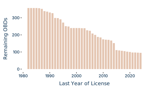
Figure 1. The number of active OBDs annually from 1982 to 2024.

A Brief History of Overboard Discharges (OBD)

OBDs were historically common in coastal or island communities where sewer infrastructure and septic systems were difficult or impossible to construct.

The number of OBDs has declined relatively steadily since the 1980s, largely as a result of grants from the state to incentivize the conversion of OBDs to alternate systems. The rate of closures has slowed since 2016 and only 16 OBDs have been closed in the last decade.

Casco-Bay-OBDs
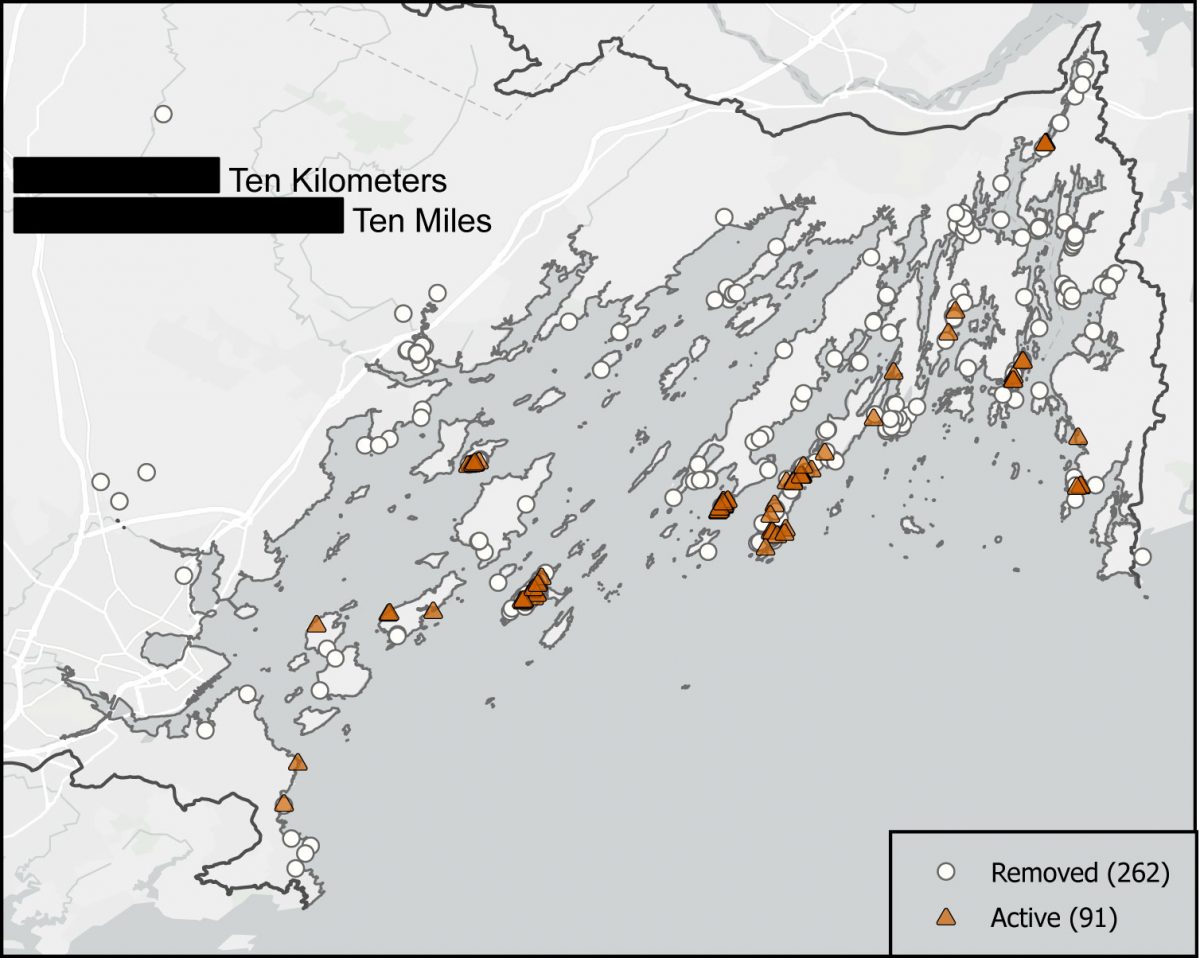
Figure 2. Map of active and removed OBDs in Casco Bay. The Harpswell peninsulas and some islands have the highest concentrations of remaining OBDS.

Islands Have Few Feasible Alternatives

There were 358 OBDs in Casco Bay in 1980. Only 92 remained active as of the end of 2024.

Nearly all the remaining OBDs are in Harpswell or associated with residences on one of a few islands. These remaining OBDs and the slow rate of closure in recent years most likely indicate a lack of feasible alternatives for many of the remaining sites rather than a reluctance to close them.

Looking Ahead to 2030

The recent work on septic systems by CCSWCD as well as the Town of Brunswick provides information that can help identify on-site wastewater disposal systems posing the greatest risk to water quality. With this knowledge of septic systems and OBDs, there are new tools to prioritize areas for monitoring and improvement.