Chapter 22. Emerging Data Sources

Data Collection Priorities and Methods Are Evolving

New Technologies, Knowledge, and Understandings Are Inspiring New Data Collection Efforts

At a Glance

Lived experience and place-based knowledge provide important information to help understand Casco Bay.

Winter de-icing salt has emerged as a major contaminant of concern for urban freshwaters.

Efforts are underway to study the base of Casco Bay’s food web.

The seafloor of Casco Bay is being mapped for the first time in over 80 years.

Since the 2021 Report

One to two sentence summary of any major changes since the last report.

As our understanding of Casco Bay and the stressors impacting it continues to evolve, so does our recognition of knowledge gaps and additional data collection needs. Fortunately, there are dozens of individuals and groups collecting data in the Casco Bay watershed, from small local efforts to state regulated monitoring programs. As a result, new sources of information are constantly emerging to address these needs.

Recent efforts include work to monitor chloride contamination in freshwaters, characterize marine zooplankton communities, understand the resilience of tidal mudflats, and map the seafloor of Casco Bay. CBEP is also working to connect with community members that hold place-based local knowledge as a result of their lived experiences and recognize the importance of those data sources.
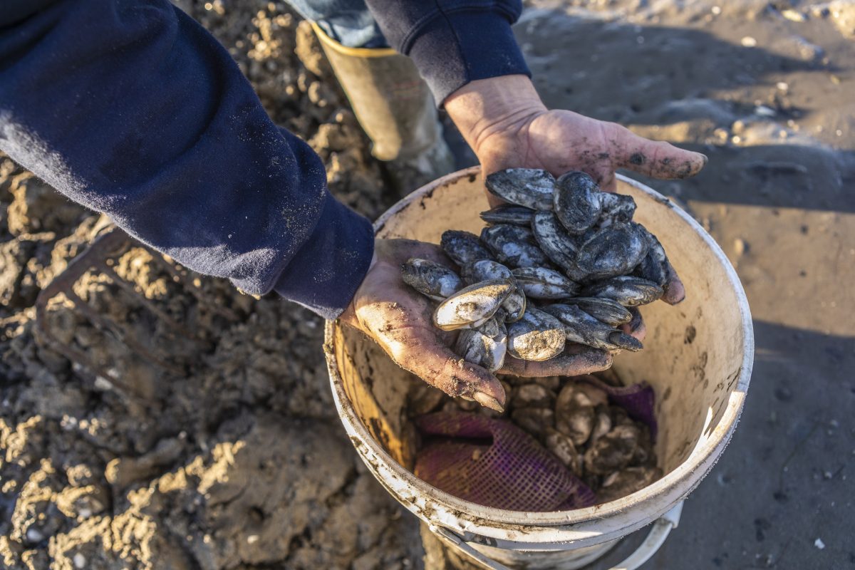
A man digs for clams in a mudflat in Brunswick, Maine.
A man digs for clams in a mudflat in Brunswick, Maine. Photo: Jerry Monkman

Place-Based Local Knowledge

Place-based knowledge is not an emerging data source. People have been gathering information about the Casco Bay watershed and using it to inform their actions and relationship with the Bay for thousands of years, since the Wabanaki first called these lands home. This has not changed, and today Indigenous communities, fishers, clammers, boaters, hikers, and more all connect with and gather information on Casco Bay in ways outside the scope of traditional scientific data collection.

Casco Bay Estuary Partnership recognizes that we have not historically included these sources of place-based knowledge in our information gathering and reporting. We are working to connect with these communities and learn from their experiences. We hope that in the future we will be able to report on some of the topics discussed here with a level of deeper understanding by incorporating the lived experiences of the diverse people that call Casco Bay home.

Chlorides From De-Icing Salt Threaten Freshwater Organisms and Contaminate Groundwater

Concerns over the contamination of freshwater by chloride from winter de-icing salt has led to recent increases in chloride and conductivity monitoring of freshwaters in the Casco Bay watershed.

Chloride contamination essentially makes freshwater “saltier” and threatens sensitive freshwater aquatic organisms that are not adapted to high levels of dissolved salts. It can also contaminate groundwater, leading to year-round seepage of chlorides into freshwater, and polluting drinking water wells. Chloride contamination in the Casco Bay watershed is getting more severe as use of deicing salt, development, and impervious surface cover all increase.

How Are Chloride Levels Monitored?

Researchers at the University of Southern Maine have been monitoring winter chloride levels in freshwater streams every other year since 2015. This developing dataset is increasing our knowledge of spatial and temporal trends in chloride concentrations, particularly in urban impaired streams.

Long Creek Water Management District has the best long-term chloride dataset in the watershed and recently developed a robust correlation between chloride concentration and freshwater conductivity (which is simpler and cheaper to measure). Their calibration is now being used by other monitoring groups, including Maine DEP, to estimate chloride concentrations across the state. As the datasets from these programs grow in the coming years, we will be able to analyze trends and variability in chloride contamination of Casco Bay’s freshwater bodies and work to find practices to reduce winter salt use without compromising road safety.

The other emerging issue with chloride contamination is the building scientific evidence that chlorides impact ecosystems at much lower concentrations than accounted for in EPA’s (1988) water quality standards.

Plankton: A Critical Part of the Casco Bay Food Web

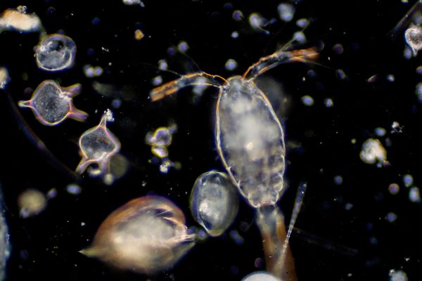
Organizations are hard at work monitoring the fish and crustacean communities of Casco Bay, but plankton monitoring has long been recognized as a major gap. Zooplankton are an essential part of the marine food web, feeding on the basal resources of phytoplankton and detritus, and making those nutrients available to higher trophic levels.

Zooplankton are so numerous and energy rich that some of the largest animals that visit Casco Bay, including critically endangered North Atlantic right whales and endangered basking sharks, feed almost entirely on zooplankton. The spatial and temporal dynamics of zooplankton in the bay influence the movements, abundance, and population health of many other marine species, including those that support commercial and recreational fisheries.

How Are Plankton Monitored?

Researchers at the University of Southern Maine and Gulf of Maine Research Institute are leading efforts to monitor plankton in Casco Bay. University of Southern Maine researchers have been collecting data on zooplankton abundance and community composition in southern Casco Bay since 2022. Starting in 2026, the Gulf of Maine Research Institute began collecting zooplankton samples with the aim of developing a long-term zooplankton monitoring program. Data from these programs will strengthen our understanding of what is driving population trends and changes in species composition in the marine community.

Plankton are organisms drifting in bodies of water. Zooplankton are small animals, typically less than 2 cm, that form the base of aquatic food webs.

Sonar and Seafloor Mapping Improve Understanding of Benthic Habitats

A surprising amount of Maine coastal waters, including Casco Bay, are charted and surveyed using very old data and techniques. For example, much of Casco Bay was surveyed between 1941 and 1943, with soundings spaced as much as 100 m apart, and has not been surveyed since (Figure 1). Maine Coastal Mapping Initiative (MCMI, part of Maine Department of Marine Resources) is working to change this by collecting high-resolution seafloor data using a multibeam sonar system along with grab samples of the seafloor to gather sediment and sediment-dwelling organisms.


The sonar data are being used to create maps of the seafloor geology and support marine spatial planning and resource management. The grab samples help improve our understanding of resident biological communities in different habitat settings and have been used to identify newly arrived invasive species in Casco Bay. MCMI combines the sonar data with seafloor sediment data to create maps and models of the seafloor characteristics. These maps are useful for identifying the location and spatial extent of important habitat types as well as resources that may be at risk from development or other changes to the marine landscape. MCMI has so far mapped portions of central and eastern Casco Bay and is aiming to complete mapping of the Bay by 2027.


****Want to include NOAA Map here

New Data on Mudflats Will Contribute to a Better Understanding of Benefits

Mudflats have not historically received the same level of attention, research time, or money as other coastal habitats like tidal marshes or eelgrass beds. The resources they produce, such as clams and worms, have been studied to understand population declines and how to increase production, but little attention has been paid to the mudflats themselves. There is now an effort underway to better understand the mudflats of Casco Bay and the benefits they provide through a partnership between Gulf of Maine Research Institute, Manomet Conservation Sciences, University of Massachusetts Amherst, and shellfish harvesters and managers.

The collaborative team is documenting historical conditions through participatory mapping with harvesters and assessing future resilience by measuring sediment characteristics, responses to changing water levels, and carbon storage. By using a combination of local knowledge, satellite imagery, and field measurements the team hopes to produce both backward-looking histories and forward-looking predictions about the conditions of mudflats. This information and the tools and methods developed in the process will be invaluable to coastal managers.

LOOKING AHEAD TO 2030

These monitoring programs and sources of information are either still in development or have short data records that CBEP is not able to analyze here, but we are following them closely to use the data they provide in future reports.

Ch. 22 Mudflats Emerging Data Sources chapter Monkman
Photo: Jerry Monkman