Chapter 12. Eelgrass

Previously Reported Eelgrass Gains Have Been Lost

Remaining Eelgrass is Mostly in Low Percent Cover Meadows and in the Outer Bay

At a Glance

Casco Bay lost 54% of its eelgrass between 2018 and 2022.

Remaining eelgrass is primarily in low-percent cover meadows, which provide fewer benefits to wildlife and the environment.

State, local, and community organizations are mobilizing in response to these declines.

Since the 2021 Report

In 2020, eelgrass in Casco Bay appeared to be recovering based on the increase in eelgrass area mapped from 2013 to 2018. Mapping in 2022 revealed that most of those increases had disappeared and Casco Bay lost 54% of its eelgrass in that four year period. Declines have continued since.

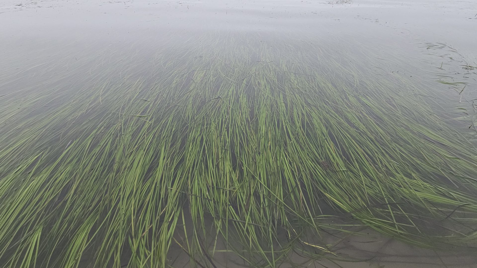
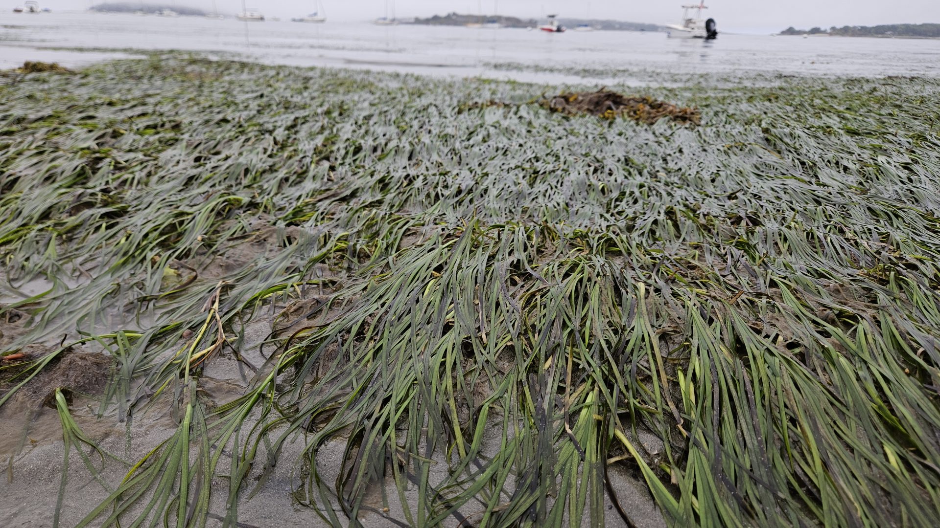
Eelgrass (Zostera marina) is a seagrass, an underwater flowering plant that has historically formed dense, swaying, emerald green underwater meadows in Casco Bay. Eelgrass is recognized by the National Oceanic and Atmospheric Administration (NOAA) as an Essential Fish Habitat and in Maine is considered a Significant Wildlife Habitat and Species of Greatest Conservation Need. It is a vital nursery habitat for young fish and shellfish, including important fishery species such as lobster and scallops. Eelgrass meadows also stabilize sediments, protect shorelines from erosion, and absorb excess nutrients in the water.

Recently, scientists have been exploring the ability of eelgrass to buffer coastal acidification and serve as “blue carbon sinks” by providing long-term storage of organic carbon in their belowground biomass. The many benefits that eelgrass provides to the ecosystems of Casco Bay are at risk however, as eelgrass has been rapidly declining.
DCIM100GOPROGOPR0889.JPG
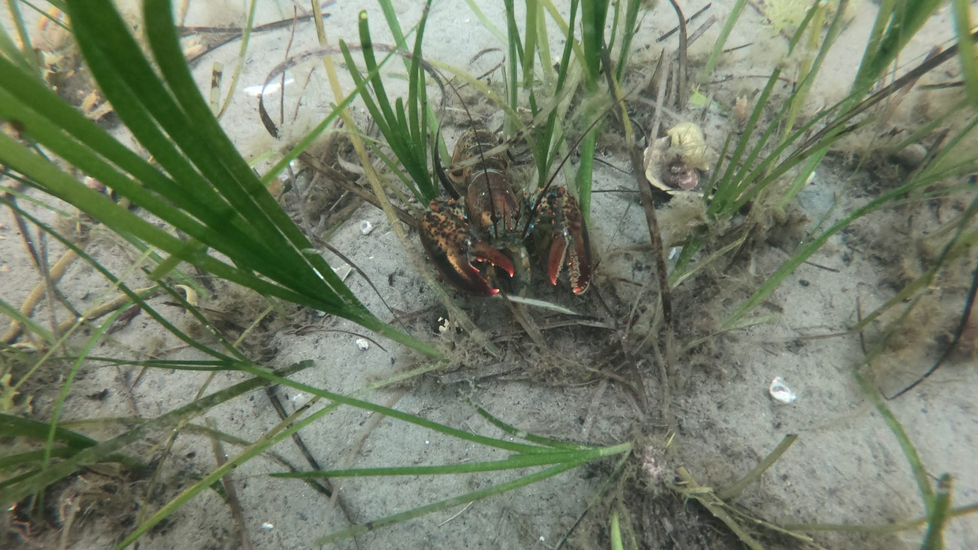
Lobster in eelgrass (Image: Glenn Page, COLBALT)

Large-Scale Loss of Eelgrass

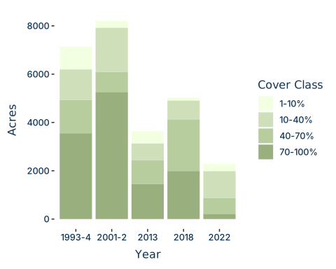
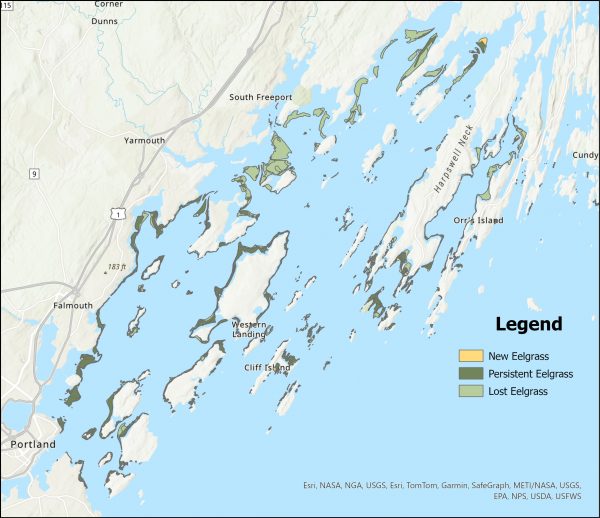
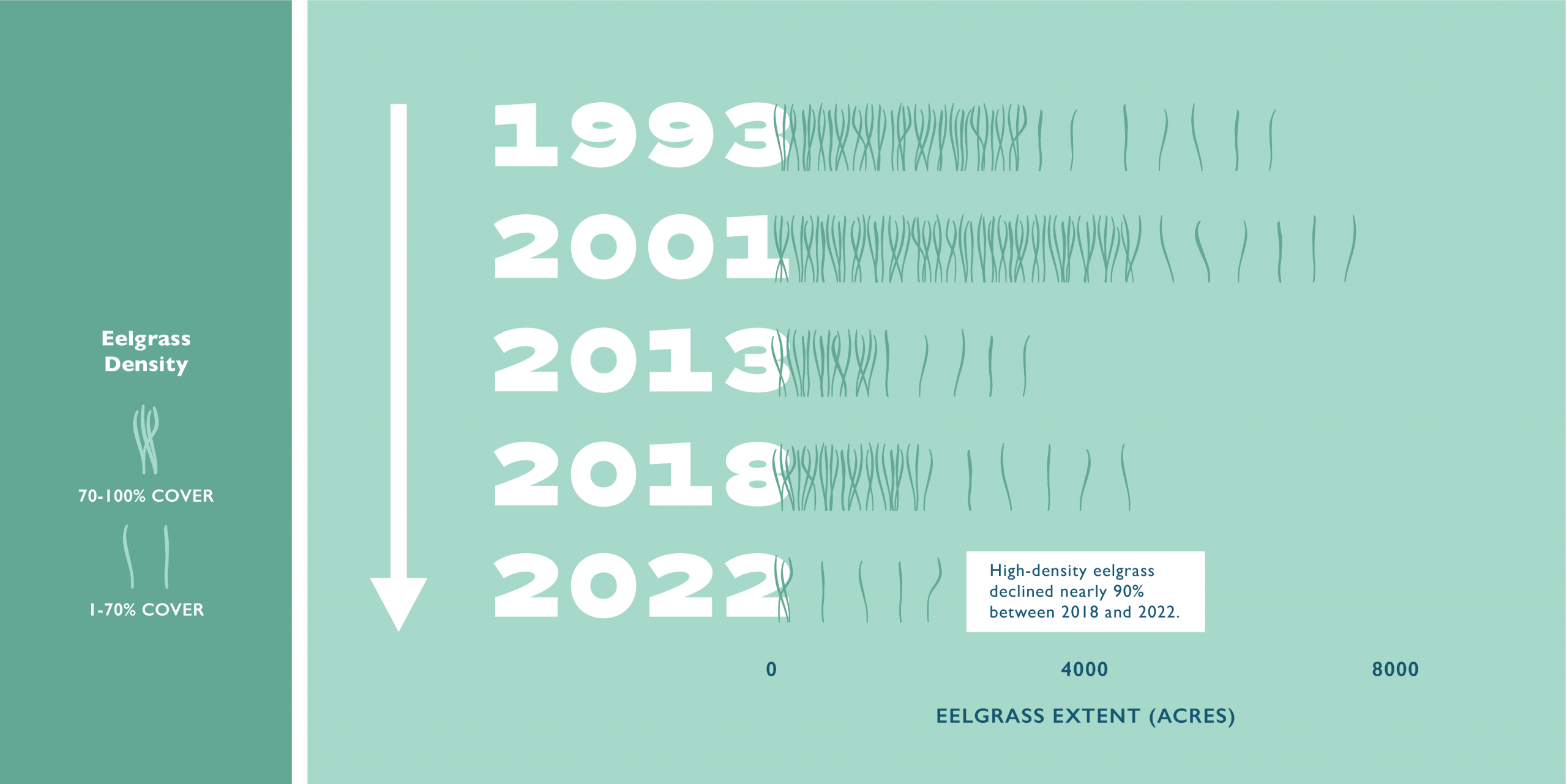
From 2018 to 2022, Casco Bay lost an estimated 54% of its eelgrass coverage, based on mapping by the Maine Department of Environmental Protection (DEP). In 2018 there were 5,033 acres of eelgrass mapped in Casco Bay, and in 2022 there were only 2,286 acres. Eelgrass in Casco Bay has not been mapped since 2022, but local observations suggest that decline has continued. Most of this loss has happened in the eastern Bay near Brunswick and Freeport, where meadows that recovered between 2013 and 2018 (the previous two mapping years) were almost entirely wiped out.

Of the eelgrass that remains, very little is in high percent cover meadows. Only 212 acres of eelgrass were mapped with 70 – 100% cover in 2022, nearly a 90% decline from the 1,987 acres of high percent cover eelgrass in 2018. The majority of the remaining eelgrass meadows in Casco Bay have only 10 – 40% eelgrass cover.

Figure 1.

Ch. 10 54258305256_328d783744_o

Causes of Loss Not Fully Understood

Figure 2. Percent cover of eelgrass meadows in Casco Bay during state mapping efforts.

The recent large-scale and rapid loss of eelgrass is concerning for Casco Bay and may impact water quality and habitat values.

Increasing water temperatures, sediment and nutrient pollution in coastal waters, human disturbance, and invasive species such as European green crabs (Carcinus maenas) can all negatively impact eelgrass, making it challenging to determine the cause of decline for a meadow without intensive environmental monitoring. Causes of decline in Casco Bay are still not fully understood and are likely the result of different factors, or interactions of factors, in different meadows. Meadows exposed to offshore waters and near outer islands appear to be in generally better condition, and natural recovery in inner Bay meadows is sometimes observed after colder winters.

Eelgrass Losses Have Galvanized Action at Local and State Levels

The past few years have seen an explosion of energy around eelgrass thanks to outreach by partners, increased collaboration, and efforts to attract external funding. This has brought renewed attention and energy to understanding eelgrass dynamics in Casco Bay and along the coast of Maine.

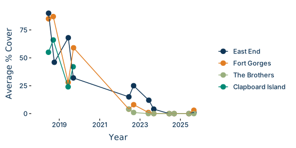
Maine DEP has led monitoring efforts at the state level. They have monitored three meadows in the Portland area annually since 2018 (with the exception of 2020 and 2021), and documented declines in eelgrass cover at all sites. Originally this monitoring was to understand the impacts of reduced nitrogen loading from the East End Wastewater Treatment Plant, but it has also provided an important annual snapshot of the condition of eelgrass in the Bay.  The state legislature also established the Maine Vegetation Mapping Program (MVMP) under Maine DEP in 2023 to survey and delineate seagrass on the coast of Maine on a 5-year rotation. They will next map Casco Bay in 2027.

Figure 3. Eelgrass % cover sharply declined at all of Maine DEPs monitoring sites in the Portland area from 2018 to 2025. The site at Clapboard Island was dropped and replaced by a nearby site at the Brothers in 2022 due to safety concerns.

Figure 4. Change map showing loss, persistence and gain of eelgrass from 2018 to 2022

Ch. 10 Team Zostera CBEP photo

Local Organizations and Volunteers Work to Fill Knowledge Gaps

Local organizations are collaborating to monitor water quality in eelgrass meadows, track the timing of eelgrass flowering and seed production, prototype restoration methods, and engage Casco Bay communities with eelgrass. As a result, new records of subtidal temperatures, light conditions, and other environmental conditions in eelgrass are increasingly becoming available. Recent efforts have also used drones to map individual eelgrass meadows to measure how meadows have changed since the 2022 mapping. There has also been an outpouring of community engagement with eelgrass, from volunteering to help with monitoring and restoration activities, to increased awareness of the values that eelgrass provides.

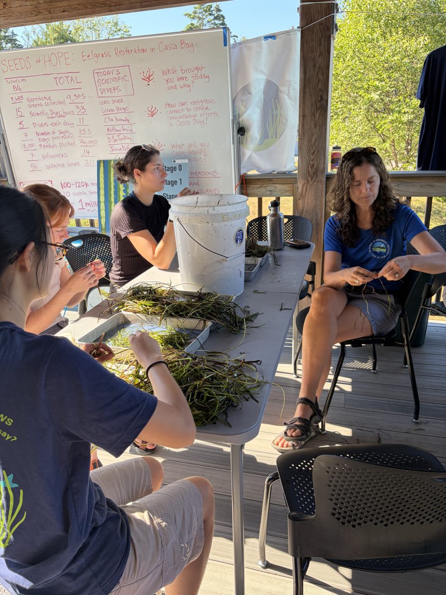
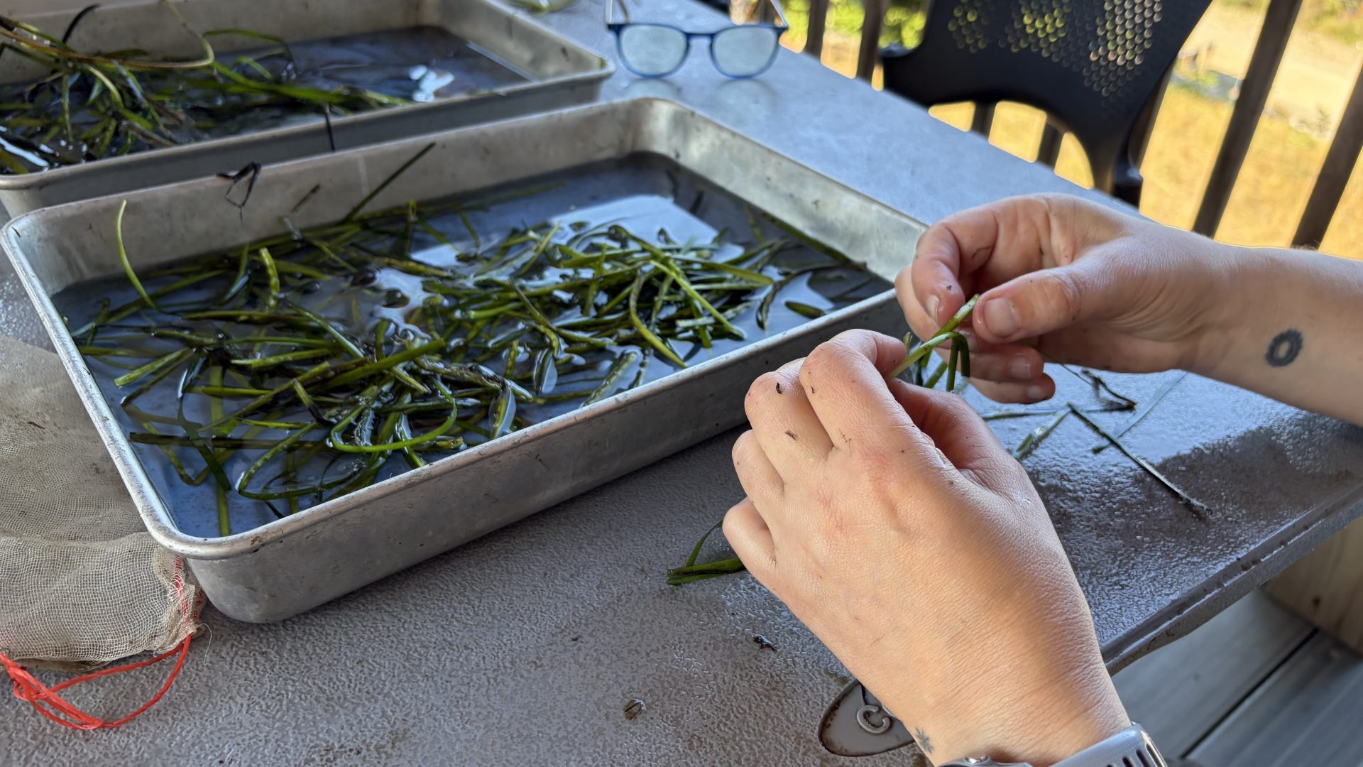
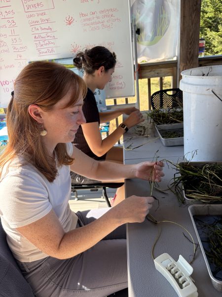
Seed plucking Team Zostera CBEP

Community Program Highlights

  • COBALT/Team Zostera Phenology Monitoring – The Collaborative for Bioregional Action Learning and Transformation (COBALT) has been working with volunteers underwater and on land to study when eelgrass meadows around the bay are producing seeds, and how many they are producing. This knowledge has allowed COBALT and partners to begin piloting seed-based restoration, which requires specific knowledge on when and where seeds are being produced in order to harvest them at a particular stage of development.
  • Friends of Casco Bay Seagrass Snapshots – Friends of Casco Bay has engaged their volunteer Water Reporters to help track eelgrass during extreme low tides by participating in Seagrass Snapshot events. Water Reporters are assigned a location where a meadow was previously documented, then take photos of the location when the tide is low enough to expose eelgrass meadows. These efforts have helped track where eelgrass has continued to decline – or occasionally reappeared – since the last state-led mapping effort.


Above: Seed plucking eelgrass with Team Zostera (Image: CBEP)

LOOKING AHEAD TO 2030

Casco Bay will next be mapped by the Maine DEP MVMP in 2027, providing us an update on the status of eelgrass. By that point, researchers hope to have a better understanding of what factors are triggering declines in different areas as a result of ongoing monitoring efforts. Bowdoin College’s Schiller Coastal Study Center and University of Maine’s Darling Marine Center are both developing facilities to process eelgrass seeds for use in restoration. The goal is to begin using eelgrass seeds to restore multi-acre meadows within the next few years. Community efforts including the phenology monitoring and volunteer tracking of meadow conditions are also continuing, and even expanding as local interest in eelgrass grows.

Ch. 10 54257416377_f829bf4c33_o