Welcome to the 2026 State of Casco Bay Report

Every year, people and organizations across the region gather information about Casco Bay. Volunteers, land trusts, nonprofits, municipalities, and state and federal agencies all contribute. Casco Bay Estuary Partnership is one part of this larger effort. We bring together information from our partners and public sources to create a broader picture of the Bay and how it is changing.

5 KEY FINDINGS


Key Finding #1

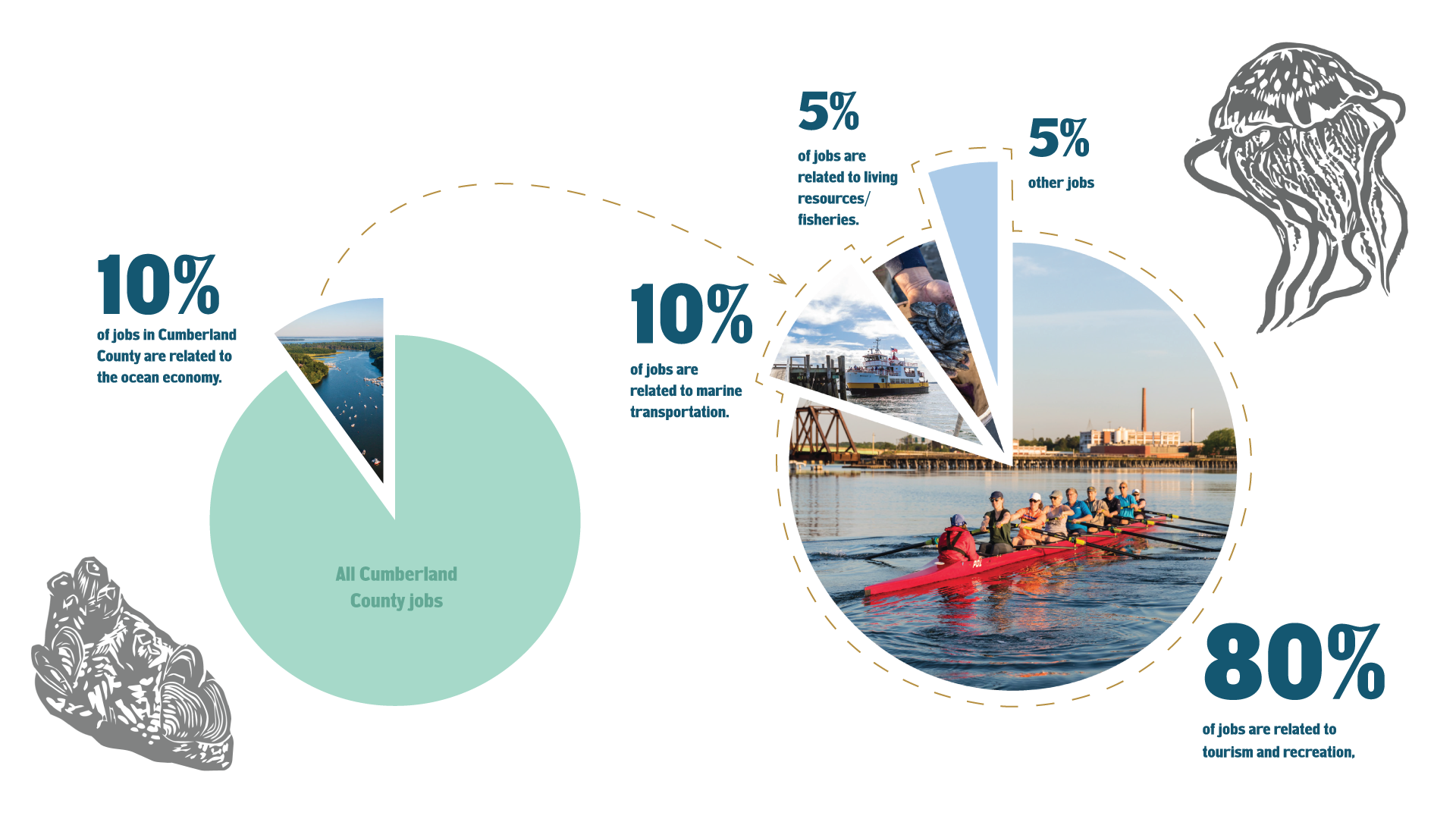
The Bay is an Economic Driver


Key Finding #2

Climate Change

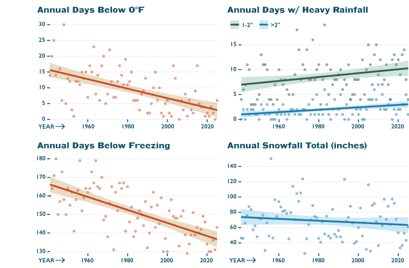
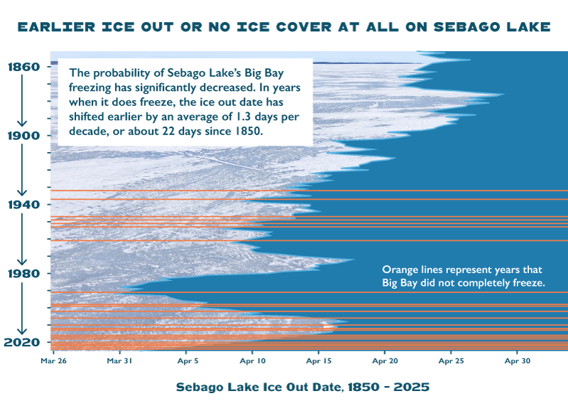
The changing climate is impacting the people, water, and habitats of Casco Bay. As fewer days reach temperatures below zero and below freezing, the growing season is longer, changing the timing of when pollinators, herbivores, and even humans interact with the plants they rely on for food.

Key Finding #3

Investing in Casco Bay

Communities are investing in water quality and the Bay by addressing sewage discharges in Portland, increasing aquatic connectivity across the watershed, and working together to restore tidal marshes.

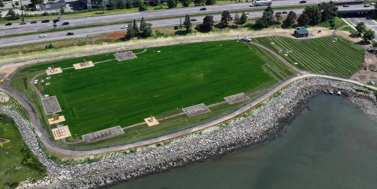
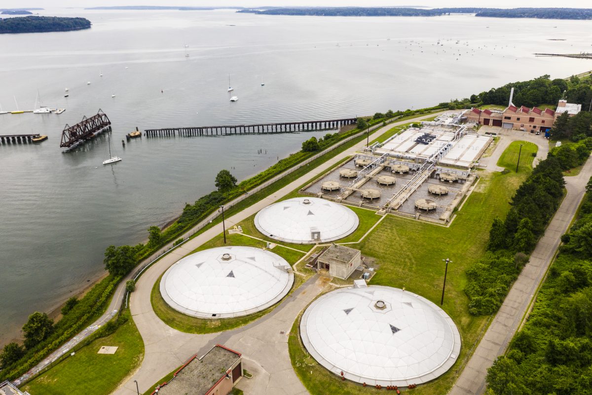
Ch. 4 Back Cove Facility
Back Cove Facility
  1. Combined Sewer Overflow Remediation
    The Back Cove South Storage Facility was a multi-year and multi-million dollar investment that has greatly reduced sewage discharge to the Bay during storm events. It is just the most visible of several projects undertaken in recent years to reduce combined sewer overflow discharges.
  2. Restoring Aquatic Connectivity
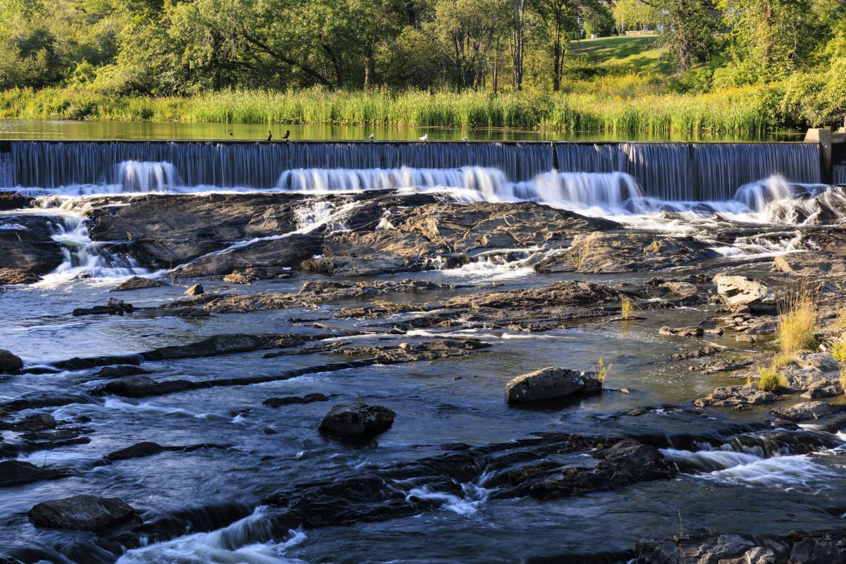
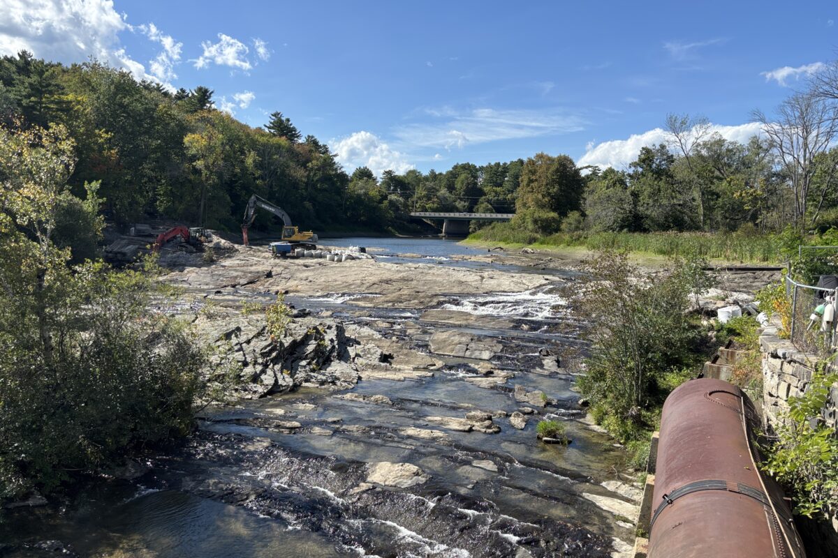
    Eight dams have been removed since 2020, reconnecting over 70 miles of riverine habitat to Casco Bay. Twelve degraded or undersized culverts have also been upgraded to StreamSmart culverts. Restoration is the result of multi-group efforts and helps to improve our road networks in addition to aquatic habitats.
  3. Tidal Marsh Restoration
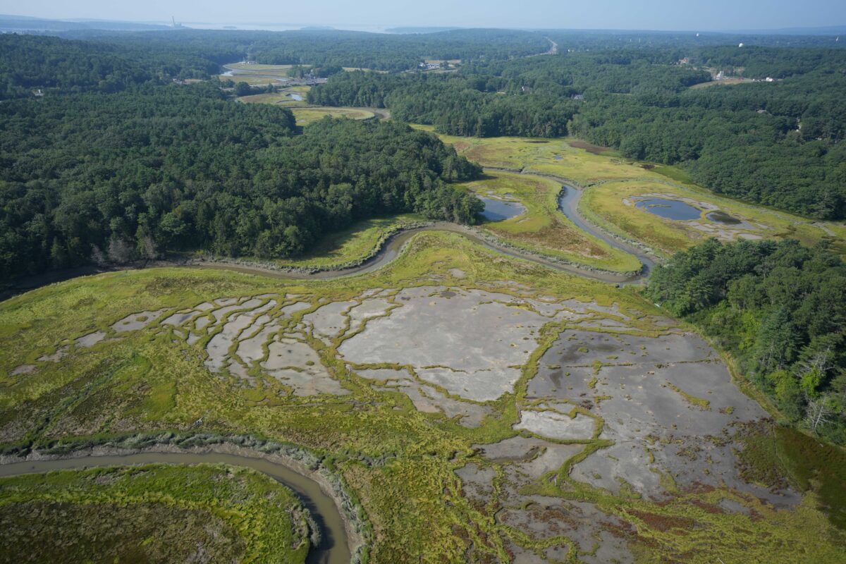
    Dozens of organizations are undertaking collaborative projects to remediate the impacts of rising sea levels and historic farming activities on tidal marshes.

Before

The Bridge Street dam on the Royal River in Yarmouth, Maine. Photo: Jerry Monkman

After

Bridge Street Dam

Walsh Preserve at Cousins Marsh. Photo: Bonnie Turek of US Fish & Wildlife Service Gulf of Maine Coastal Program

Key Finding #4

Changing Data for a Changing Bay

Data collection needs, methods, and technology are all evolving rapidly. In response, monitoring organizations are changing the types of data they collect and how they collect it.

Access to new types of data and more continuous data provides opportunities to detect patterns and trends that were previously undetectable. But it also presents challenges in data management and analysis.

New data sources are constantly becoming available, helping us to deepen our understanding of the Bay. We are aware of evolving efforts to better incorporate place-based knowledge, collect data on freshwater chloride levels, marine zooplankton, and mudflats, and to produce high resolution bathymetry maps of Casco Bay. We hope to include outcomes from these efforts in our next report.
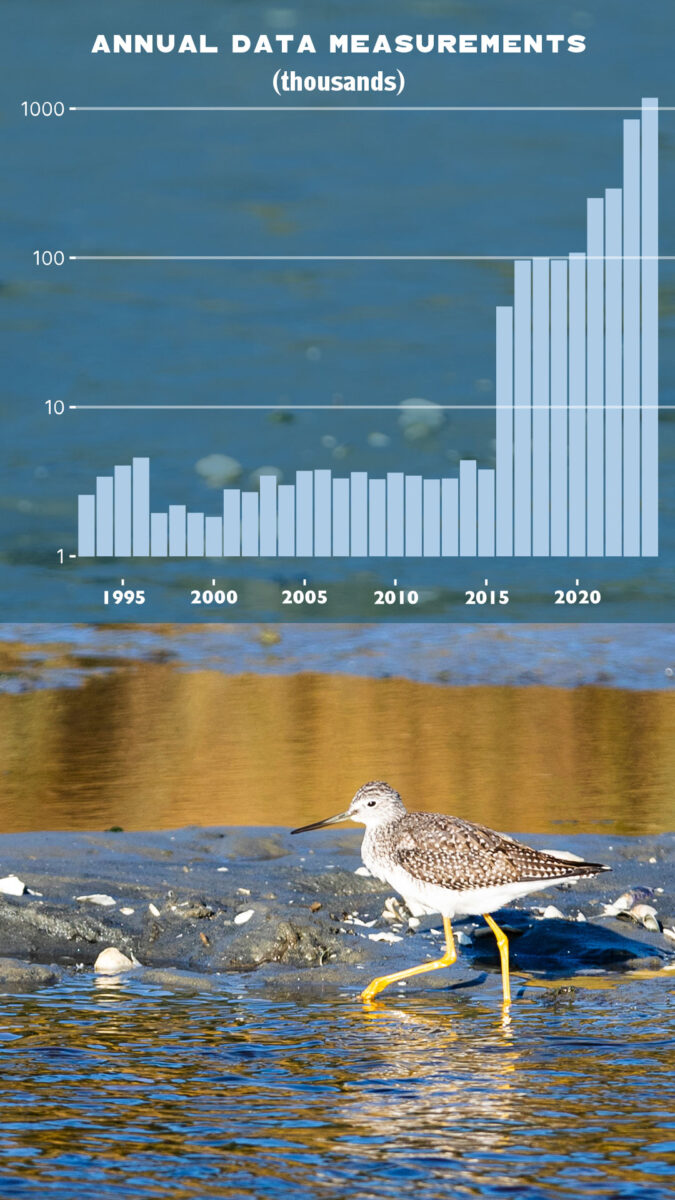
The number of water quality data points collected by Friends of Casco Bay annually, on a log scale. Continuous monitoring stations were added in 2016 and 2021 | Photo: Jerry Monkman
Key Finding #5

Community Initiatives

Two major projects have recently come to fruition after decades of focus and action from local community members. Collaborative efforts around land conservation as well as volunteer stewardship and education continue to play an important role in moving forward key initiatives.

An aerial view of Portland, Maine’s wastewater treatment plant on the shores of Casco Bay. Photo: Jerry Monkman

Construction of the Confined Aquatic Disposal cell to hold contaminated sediments dredged from Portland Harbor began in winter 2024. The Waterfront Alliance was a major force in planning and coordinating the work, conducted in association with Portland and South Portland, the Portland Harbor Commission, the Maine Department of Transportation and others.

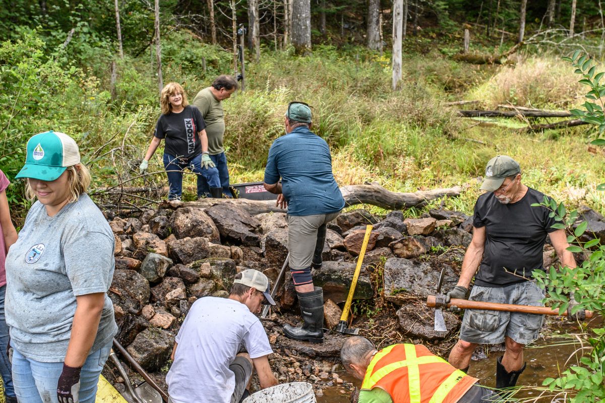
Photo: Sebago Clean Waters

Hundreds of volunteers donate thousands of hours of their time to support community science, environmental education, and land stewardship across the watershed.

Photo: Jerry Monkman

The Bridge Street Dam on the Royal River in Yarmouth was removed in summer 2026. Leadership from town officials and local groups like The Royal River Alliance was instrumental in building community support over the years.

Photo: Presumpscot Regional Land Trust

Community supported land trusts, conservation organizations, and collaborations like Sebago Clean Waters have conserved and permanently protected nearly 80,000 acres of the Casco Bay watershed.

Data Repository

Coming soon…

Block print artworks by Jordan Kendall Parks